
There are affiliate links on this page. Read our disclosure policy to learn more.
Some studies show that sea levels are rising:
LATEST MEASUREMENT: November 2014
shows a 59.5 mm rise in Sea level which NASA says is caused primarily by two
factors related to global warming:
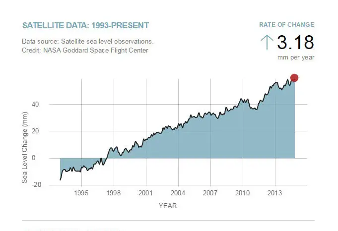
The first chart tracks the change in sea level since 1993 as observed by satellites.
Note: You will see a few news stories and claims that these tables use data fabricated by computer models, but those allegations have been roundly refuted. The need to adjust the data was based on a number of technical changes. In the mid 1980s, the government settled on a list of about 1,200 stations across the country to track temperature trends. Around 1990, climatologists began delivering computer programs to factor in the artificial changes that systematically pushed the readings one way or the other. Over time, they accounted for the impacts of equipment, location, the time of day of measurements and urbanization (more asphalt leads to higher surface temperatures). See this Wikipedia article for the full story.
The second chart, derived from coastal tide gauge data, shows how much sea
level changed from about 1870 to 2000
Here is a link to the data. This file contains Global Mean Sea Level (GMSL) variations computed at the NASA Goddard Space Flight Center under the auspices of the NASA MEaSUREs program.
-->